Quiet weather Friday as showers approach for the weekend into early November
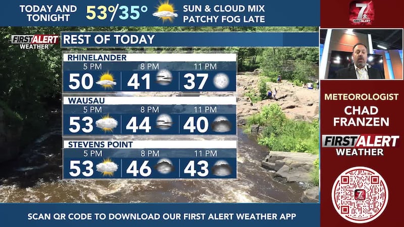
- NEXT 12: Sun and cloud mix, seasonal temps
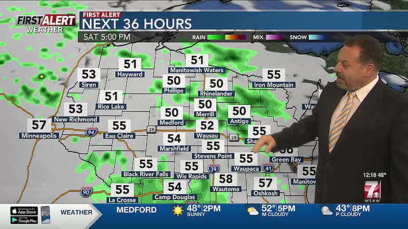
- SHORT TERM: Few Halloween showers, mainly cloudy
- LONG TERM: Widespread rain early next week
WAUSAU, Wis. (WSAW) - Relatively quiet and calm conditions return Friday as Wisconsin’s next storm system approaches throughout the weekend into early next week.

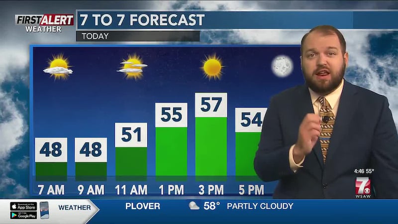
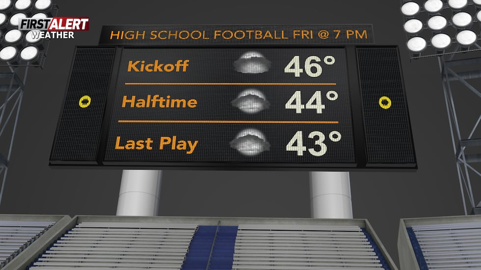
More clouds than sunshine continues Friday afternoon as temperatures climb back into the lower 50s for the day. Temperatures drop back into the mid-40s by the time we get to any high school football games for any teams still in the playoffs.
What’s coming up
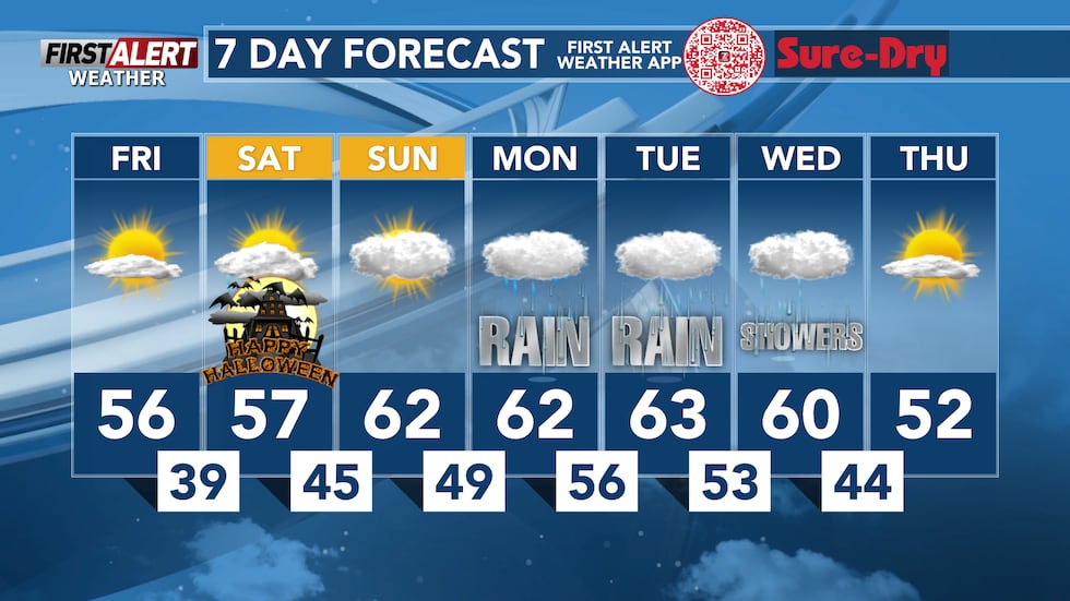
This weekend features mainly cloudy skies on Saturday and Sunday. It won’t be as chilly we were Friday morning, but frost can stilll be expected to develop up north Saturday morning.
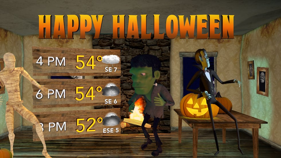
A few showers remain possible during the afternoon on Halloween. By the time we reach late-night parties, most showers should be out of the area. Highs top out in the mid-50s for most of the area. Sunday will be milder with no rain in the forecast.
Looking ahead
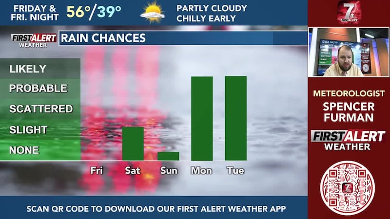
There is a lot more rain on the way next week. Our best chance for rain, over the next week or so, will be on Monday & Tuesday with rain likely starting Monday afternoon. Rain continues into Wednesday, but won’t be as widespread. It’s too early to tell how much rainfall we will get, but there is potential for over an inch of rain in some spots due to how slow this system will be moving as of now, but stay tuned for further updates as this could change.
More forecast details

Here’s a look at your First Alert Weather Forecast for central Wisconsin over the next 12 hours. Don’t forget to check back for the latest forecast.
Click here to download the WSAW News app or our WSAW First Alert weather app. Submit Weather photos here!
Copyright 2026 WSAW. All rights reserved.