Dry start to the week, wet end to the week
- NEXT 12 HOURS: Early clouds, isolated south showers
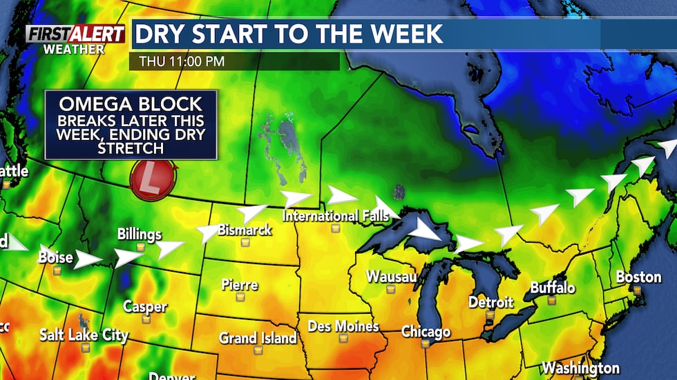
- SHORT TERM: Dry stretch continues
- LONG TERM: Showers and storms possible
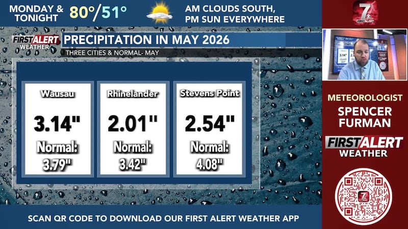
WAUSAU, Wis. (WSAW) - Unless you get an isolated shower, it’s dry weather as we have had the last few days once again.

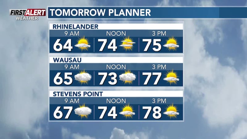
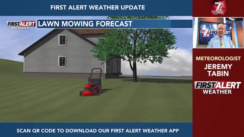
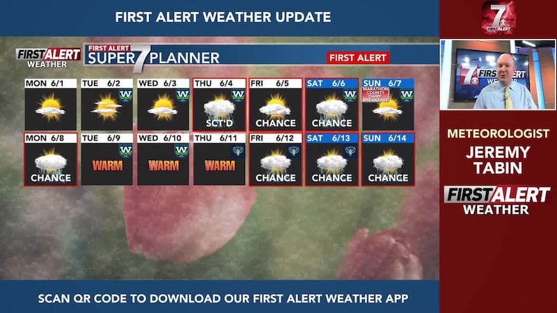
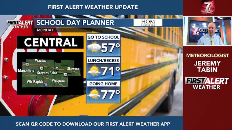
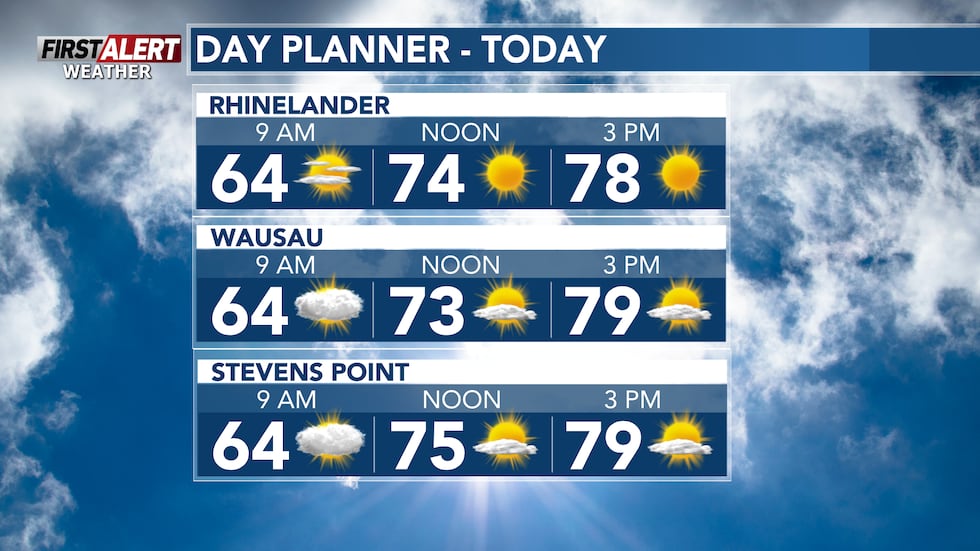
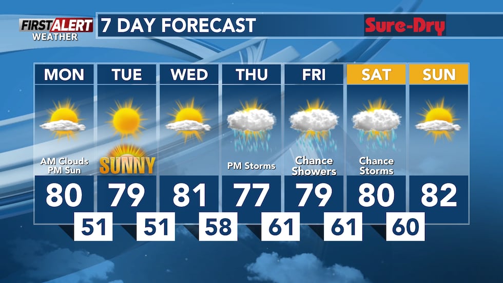
Monday will feature more clouds earlier in the day compared to mainly sunny skies that are expected during the afternoon. The further southwest you live, the more cloud cover you may see during the first half of Monday. Temperatures are expected to top out in the upper-70s and low-80s during the afternoon. A quick shower or two cannot be totally ruled out if you live around or south of Highway 29, but most of us will stay dry on Monday.
What’s coming up
The dry weather continues on Tuesday and Wednesday as well. Tuesday is aiming to be sunnier than Wednesday, but both days are looking dry with highs in the mid to upper-70s on Tuesday and upper-70s and low-80s on Wednesday. Light winds are expected over the next few days. This will help keep fire danger moderate for most of the next few days.
Looking ahead
Fire danger will drop toward the end of the week as dry weather ends on Thursday. Showers and storms are possible later in the day. It’s too early to say how strong any potential storms could become. More rain is also in forecast on Friday and Saturday as well. Once again, it’s too early to tell how strong any potential storms could become here as well. High temperatures will remain Summer-like for the entirety of the next week or so.
More forecast details

Here’s a look at your First Alert Weather Forecast for central Wisconsin over the next 12 hours. Don’t forget to check back for the latest forecast.
Click here to download the WSAW News app or our WSAW First Alert weather app. Submit Weather photos here!
Copyright 2026 WSAW. All rights reserved.